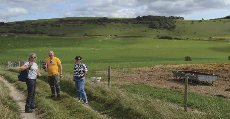
This month, Robert Veitch and his three friends; Cheryl, Ruth and Stephen ventured to the beautiful landscape around High Salvington. Their version of the fantastic four went in search of adventure and they recommend you do the same
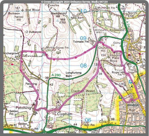
From the lower end of the car park on Bost Hill walk north between the two lime green posts, then between the lines of barbed wired, along the flint-speckled path of Roger’s Lane to the four-way fingerpost.
Continue straight on, then around to the left into the valley towards the glass houses, where the path turns right onto the concrete drive. After 250m turn left and walk uphill for 100m, before turning right and ambling around the wooden five-bar gate.
Continue through the arboreal tunnel, eventually arriving at the tarmac drive. Turn left and enjoy the avenue of trees on the approach to the church of St John the Baptist, which dates from the 11th century.
The path continues to the right of the church, through a kissing gate into a field. Follow the left side boundary to a stile, then past Findon cricket ground, veering up the slope before turning sharp left and more steeply uphill to a redundant stile.
Once past the stile, up and over the brow, the panorama opens up dramatically. Continue to the busy road and cross with care to the drive opposite. 50m along the drive turn left and downhill, along the Monarch’s Way into the Long Furlong valley.
Once past the metal gate and the ‘beware of the bull’ sign, the track continues, rolling through the epic grandeur of the landscape, blowing away any lingering cobwebs.
Over the crest and beyond a gate, the path stretches out downhill towards the distant beech trees and gate, before easing uphill, eventually joining a tarmac drive.
Turn left, then right almost immediately, and wander between the hedges of Myrtle Grove for 400m, eventually arriving at a three-way fingerpost by a wall box in the flint building marked ‘GR.’
Bear left, then right almost immediately and continue west for half a mile to the road at Michelgrove Lane. Turn left and follow the road downhill and around a left hand bend.
Turn right 100m beyond the bend and walk between the crops. “A lovely place for a picnic,” noted Ruth as she sat down, opened her knapsack and offered refreshments. Continue into the woods and walk uphill to the crossroads and four-way fingerpost.
Turn left, and wander along the plateau to the gate at the entrance to Patching Hill. The giant beech tree above is exceptional.
Beyond the gate, keep right, following the path as it cuts a thin line in the grass, passing the skeleton tree on the way to a gate on the right by the fingerpost. Once through the gate turn left and head downhill to The Street.
Continue downhill, past the church of St John the Divine on the right, and spine-chilling scarecrows on the left, into Patching. In the village centre, turn left into Coldharbour Lane and walk 450m to the main road, which feels relatively noisy after the tranquility of the downs.
Turn right, then walk up to the puffin crossing to cross the road in safety. Walk through Clapham along The Street, rejoicing as the sound of traffic fades into the background.
Just beyond Woodland Close, turn sharp left, uphill past the pampas grass and into Clapham Wood. Plenty has been written about Clapham Wood; the supernatural, unseen forces, the discovery of bodies in the 1970s and the occult, but we marched on regardless.
As Cheryl noted, “It’s a bit dense and overgrown in places, but actually the wood is really nice and peaceful, nothing to be scared of.”
Continue in the same northeasterly direction, past a field on the right, then a field on the left, heading into the scrub when the fields end. At the three-way split, bear left and continue to a T-junction.
Turn left into Richardson’s Wood and gradually witness the light penetrating the canopy above as the path widens beneath; before emerging joyously into a field, high above Long Furlong, with the road below bisecting the valley.
The path follows the contour lines, gaining altitude very gently, passing sloe berries near the silver gate at Church Hill; the highest point of the day at 136m (445 feet).
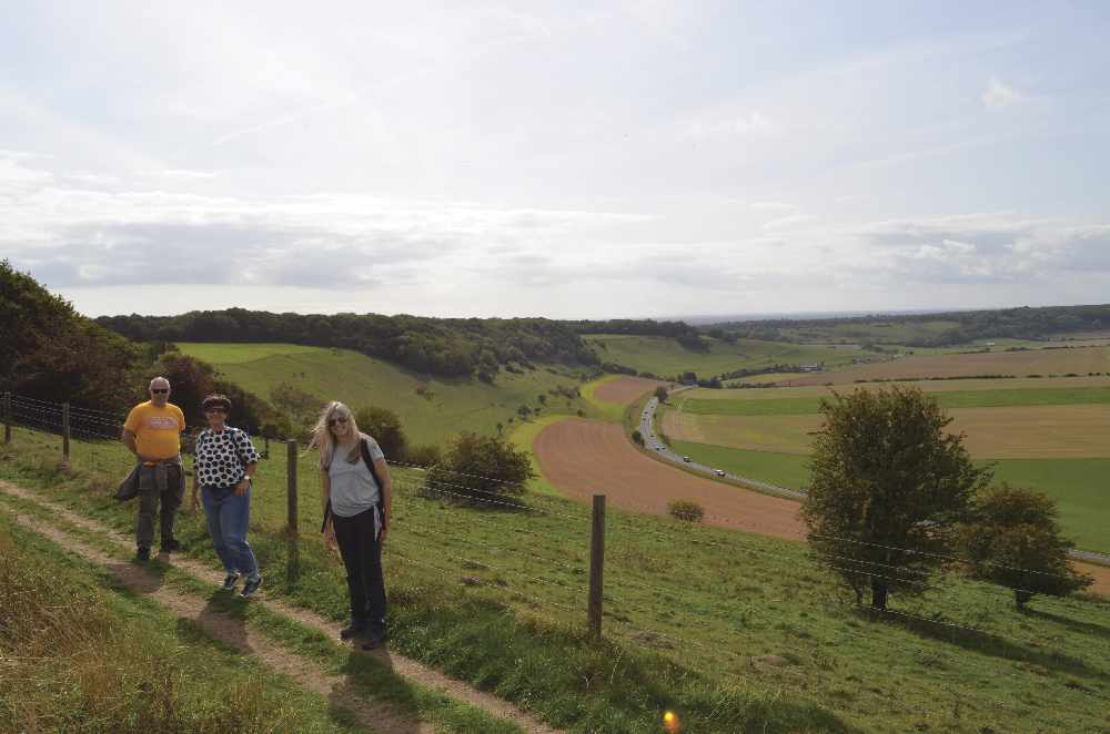
Beyond the gate, turn right, then right again into Honeysuckle Lane. Potter south along the track, enjoying the views across Worthing, before passing the transmitter aerials at West Hill, finally emerging at the fringes of High Salvington surburbia a mile later.
At the crossroads, turn left into Furze Hill and walk past the ‘tin tabernacle’ of St Peter’s Church to the High Salvington windmill. Continue alongside the post and rail fence to the dog waste bin, before descending the 6½ zig-zags to The Gallops below.
At the bottom of the zig-zags turn left and head back to the car park 400m away. The self styled fantastic four finished their afternoon with a socially distanced drink at a local pub.
“What a wonderful walk,” exclaimed Stephen as he supped his well-deserved pint in the late afternoon sunshine.
- Distance: 9¼ miles
- Walk Time: 3½ - 4 hours
- Stiles: 2
- Map: Explorer OL10
- Elevation Gain: 250m (820 feet)
- Calorie Burn: Approximately 850kcal
- Refreshments: Take a picnic or treat yourself afterwards
- Parking: Free parking in the Bost Hill car park

 It's a Dog's Life: A Decade of Dog!
 December Book Reviews
 If You Ask Me: Flo’s Virtual Bookshop
 Kids Zone: Christmas Traditions
 Book Reviews: November Novels... and more!
 What to Watch in October 2024
 Kids Zone: Spooky Spider's Webs
 If You Ask Me: Humanity's Greatest Invention
 If You Ask Me: A Desert Island Drag
 Kids Zone: Mud Kitchens
 What to Watch in July 2024
 Kids Zone: Ice Block Treasure Hunt!
 What to Watch in June 2024
 A Gourmet Escape on the Eurostar: London to Amsterdam with Culinary Delights in Almere
 If You Ask Me: Train Announcements Have Gone Off the Rails
 If You Ask Me... Never Argue with an Idiot
 Kids Zone: Mosaic Art
 What to Watch in April 2024
 If You Ask Me: The Jobsworth and the Frog
 What to Watch in March 2024