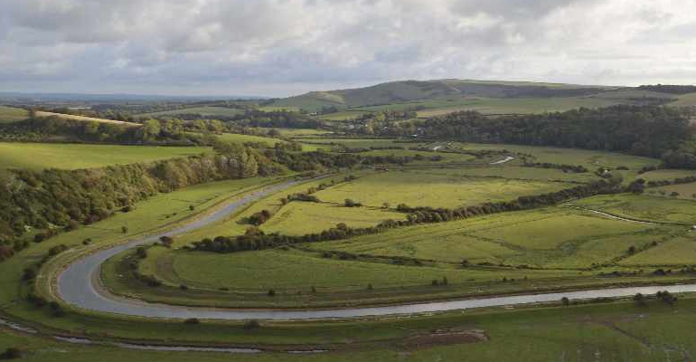
Though daylight hours might be shortening and early frosts might be upon us, there’s still time to explore and enjoy the landscape this November, so we sent Robert Veitch to Exceat and the Cuckmere Valley to marvel at the landscape… and get some exercise.
From the car park entrance, turn left onto Litlington Road, arriving almost immediately at the junction with the A259. Cross with care to the pavement opposite, and walk west towards Exceat Bridge. Though noisy, it will not last for long. Across the bridge, follow the pavement for almost 200m, rising up above the rooftops of the cars, culminating at a gap in the hedge on the right.
Across the stile, bear left, and follow the line of grassy green carpet around the contour, then alongside the fence, up and over the brow onto Ewe Down. If there are livestock about, please show them all necessary respect.
As the drone of traffic becomes distant, the squawking chatter of cormorants, gulls, swans and canada geese inhabit the airspace instead.
Follow the grassy green carpet alongside the meanders of the Cuckmere River as far as a pair of upright railway sleepers. Beyond the sleepers, keep right and hug the hawthorn on the dip down into Brock Hole Bottom, then continue up a small incline on the other side. Keep wandering northeast, the river and flood plain on the right and Brock Hole Down on the left. A pair of gates precede the levee, which leads to another stile at the end of the field.
Over the stile, turn left immediately and across the little bridge adorned with a pair of mini-stiles, then follow the ditch to the steps at the base of the climb. The path up to High and Over looms like a weeping scar in the landscape, bleeding white chalk and impending suffering. It appears more alpine than downland, but will be worth the effort. Sixty-five steps populate the severest section of the ascent, after which it remains steep, but seems a little easier all the same. At the kissing gate, stop, turn, and admire the momentous grandeur of the surroundings.
Behind the fence on the right is a geoglyph called the Litlington White Horse. First cut in 1836 it was remade in 1924. Up close, it’s less impressive than it will appear later, from across the valley.
After the kissing gate, there are opportunities to rest at one of many memorial benches. The summit of High and Over at 97m (315 feet) is the highest point of the day; it’s marked by a sandstone octagon topped with a memorial to William Rees Jeffreys.
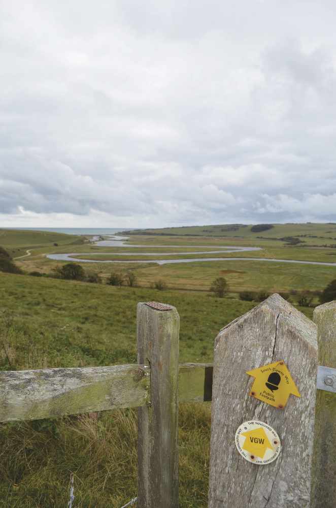
Veer right where the path splits, then right at the next split and downhill to a gate onto pasture. Beyond a lonely metal gate, the path sweeps right to a third gate. From here, aim right towards the Cuckmere River to rejoin the levee. Wander upstream past a stile before arriving at the Frog Firle bridge.
Across the bridge turn left, then after 50m turn right and follow the path into Litlington. Turn right and ramble along The Street between the pretty flint-walled properties.
After 100m, turn left into Clapham Lane, following the tarmac uphill, bearing right onto concrete, which then becomes track. At the farm buildings and silage clamp, keep left.
The track eases it’s way to a brow, then down into a hollow and up the other side before curving left towards a gate at the entrance to the rustic autumnal shades of Snap Hill and Friston Forest.
Through what is mostly beech woodland, the path continues downhill to a crossroads in the dry valley of Charleston Bottom. Turn right and amble past (or pick) the last sloe berries of autumn, to the gate.
The path on the other side snakes diagonally uphill, past a rowan tree to a gate.
Beyond this gate, continue downhill along the path between the trees to the asphalt. Follow the asphalt in the same direction, bearing right after 250m where the asphalt heads left and uphill. Beyond the ‘Westdean’ fingerpost and the black gate, follow the driveway to the T-junction with the road at the hidden hamlet of Westdean. Turn right and walk past All Saints Church (some of which dates from Saxon times) around the left hand bend to the junction.
Across the other side in the woods are 128 steps and the final challenge of the day. Once the challenge has been overcome, the path emerges from the trees by a wall and a gate, to offer a final epic panorama of the day in the form of Cuckmere Haven. Descend across the field to the kissing gate below. Keep right and follow the block paving back to the car park.
A wonderful walk and worthy of reward, I went home and made sloe gin.
- Distance: 6¼ miles
- Walk Time: 2¼ - 2½ hours
- Stiles: 5
- Map: Explorer OL25
- Elevation Gain: 235m (770 feet)
- Calorie Burn: Approximately 550kcal
- Refreshments: Take your own or treat yourself afterwards
- Parking: Pay parking at the Seven Sisters Country Park
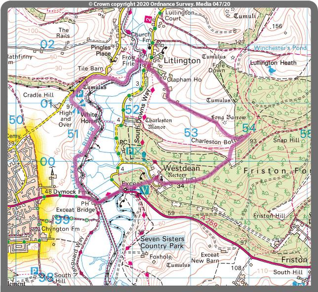
Robert has tested the route personally, making sure it is suitable for walking. However, even he cannot guarantee the effects of the weather, or roadworks, or any other factors outside of his control. If you would like to send your feedback about a local walk, please email editorial@sussexliving.com

 December Book Reviews
 If You Ask Me: Flo’s Virtual Bookshop
 Kids Zone: Christmas Traditions
 Book Reviews: November Novels... and more!
 What to Watch in October 2024
 Kids Zone: Spooky Spider's Webs
 If You Ask Me: Humanity's Greatest Invention
 If You Ask Me: A Desert Island Drag
 Kids Zone: Mud Kitchens
 What to Watch in July 2024
 Kids Zone: Ice Block Treasure Hunt!
 What to Watch in June 2024
 A Gourmet Escape on the Eurostar: London to Amsterdam with Culinary Delights in Almere
 If You Ask Me: Train Announcements Have Gone Off the Rails
 If You Ask Me... Never Argue with an Idiot
 Kids Zone: Mosaic Art
 What to Watch in April 2024
 If You Ask Me: The Jobsworth and the Frog
 What to Watch in March 2024
 If You Ask Me... Politicians need a Translator