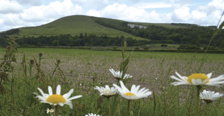
High summer is with us so we sent Robert Veitch to one of the highest points of the county, for a walk with two starting points; one high and one low. His friends Cheryl and Jo provided the company, the wit and the good looks, while all three enjoyed the superb scenery
FROM GLYNDE
At 8m (26 feet) above sea level Glynde Station is the altitudinal low point of the day.
Follow the pavement south from the station, around the corner and past the redundant pub. After 100m turn right by the fingerpost, and scamper down the narrow footpath then across the track and meadow to the gated footbridge by the willow trees. Across the next meadow is a gate beneath the ash tree, leading to a wheat field.
Follow the edge of the field, before aiming diagonally through the ripening crops to the distant gap in the hedge. Once though the gap veer left towards the cycleway, then turn right and cross the bridge with metal barrier.
The peaceful domed summit of Mount Caburn to the right, sits uncomfortably with ever-increasing drone of traffic to the left. Continue to the A27, crossing with great care at the bollarded traffic island.
Turn right and continue west, past the post box then around to the left to join the pavement of the A26.
After 100m, there is the option to cross the road and see The Parish Church of St. Andrew, Beddingham. Parts of this church are 800 years old and along with the triplet of attendant pine trees it’s a worthy distraction for a few minutes.

Back at the A26, and once through the kissing gate on the left, aim right of the farm buildings towards the two-step stile. Treat any livestock in the field with due respect. Wander across the adjacent paddock to the two-step stile in the far corner and then through the stone squeeze stile and stinging nettles.
Keep left of the hedge and walk along the right side of the maize field as far as the tarmac drive. The 2-way fingerpost points through the rapeseed, then alongside trees, to the yew hedge and lush vegetation, emerging at the junction with Littledene Lane by the red post box.
Turn right and note the gradual ramping up of the gradient. “They’re Beddingham transmitters up there,” noted Jo with a smile, “two church spires to the modern temple of instant communication,” as she looked at the walking app on her mobile phone.
At the smorgasbord of gates, take the metal 7-bar gate on the far left. As the surface underfoot degrades, the gradient increases on the ¾ mile schlep to the summit. “It’s quite a workout,” chuckled Cheryl, “I’m glad I had my morning porridge.”
At the cattle grid the junction is made with the South Downs Way. On a clear day the views in every direction are utterly gorgeous; a panoply of panoramas creating memories to recall on a winter afternoon in front of a log fire.
Turn left and ramble past the transmitters at 185m (605 feet), then over the brow along the easy walking ridge of the South Downs. One gate leads to another and into the car park, and what is the end of the walk for those that started here. Or, like us, you might be barely half way around.
FROM FIRLE CAR PARK
The gate on the eastern side of the car park leads towards the summit of Firle Beacon, a mile away; via an open gateway lined with Armco and then another gate.
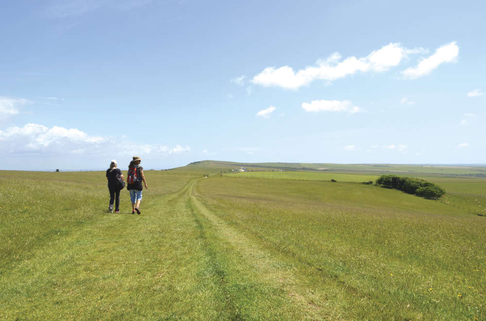
The trig point among the tumuli, at 217m (712 feet) it is the altitudinal high point of the day and the tableau of topography in every direction should be worth the walk. Stunning Sussex scenery satiated, turn through 180° and after about ¼ of a mile, veer right by the solitary fingerpost and begin the descent proper down the chalk path.
Past the fingerpost and upright sleeper, the folds in the scarp side of the Downs add magnitude to any walk. To think how this landscape evolved over millennia is enough to make the mind boggle. A gate leads into a field of ripening wheat, the path following the periphery to the T-junction with the bridleway.
Turn left and track the flint wall for ½ mile into The Street, veering left at the village shop, then along the track to the right of the pub.
At the cricket ground, veer left through the kissing gate beside the tennis courts. Aim across the field, treating livestock with respect, (to the temporary metal gate in the far corner) and the kissing gate beyond. Walk towards the drive, then through the white gate to the five-ways junction beside the Firle sign, and “the last of the jubilee commemorabilia,” noted Jo.
Cross to the bus stop then take the track to the right. Veer left of the hay barn, then right and follow the left side of the stock proof fence to the gate. Across the adjacent field is a metal 7-bar gate, and across the field beyond that, a two-step stile leads to a track. Turn right, and continue past the broad beans, to the red post box from earlier on.
Turn right and walk north along Littledene Lane to the A27 junction. Cross over with great care; the vehicles seem unnaturally fast after the sedate pace of a walk. Follow the pavement of Lacey’s Hill into Glynde. Walkers beginning at Firle car park should turn left at the fingerpost 100m before the station.
If like us, it’s journeys end, then continue to Glynde station. “I’ve earned a slice of gin and tonic cake,” grinned Cheryl, “and a life affirming cup of tea!”
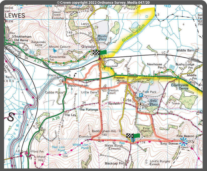
- Distance: 8¾ miles
- Walk Time: 3½ - 3¾ hours
- Stiles: 4
- Kissing Gates: 3
- Footwear: Trainers should be fine at this time of year
- Elevation Gain: 237m (778 feet)
- Calorie Burn: Approximately 815 kcal
- Map: OS Explorer OL11 or OS Explorer OL25
- Parking: Free parking at Glynde Cricket Ground and Firle Beacon car park at the summit of Firle Bostal
- Trains: See southernrailway.com for services to and from Glynde
Robert has tested the route personally, making sure it is suitable for walking. However, even he cannot guarantee the effects of the weather, or roadworks, or any other factors outside of his control. If you would like to send your feedback about a local walk, please email editorial@sussexliving.com

 December Book Reviews
 If You Ask Me: Flo’s Virtual Bookshop
 Kids Zone: Christmas Traditions
 Book Reviews: November Novels... and more!
 What to Watch in October 2024
 Kids Zone: Spooky Spider's Webs
 If You Ask Me: Humanity's Greatest Invention
 If You Ask Me: A Desert Island Drag
 Kids Zone: Mud Kitchens
 What to Watch in July 2024
 Kids Zone: Ice Block Treasure Hunt!
 What to Watch in June 2024
 A Gourmet Escape on the Eurostar: London to Amsterdam with Culinary Delights in Almere
 If You Ask Me: Train Announcements Have Gone Off the Rails
 If You Ask Me... Never Argue with an Idiot
 Kids Zone: Mosaic Art
 What to Watch in April 2024
 If You Ask Me: The Jobsworth and the Frog
 What to Watch in March 2024
 If You Ask Me... Politicians need a Translator