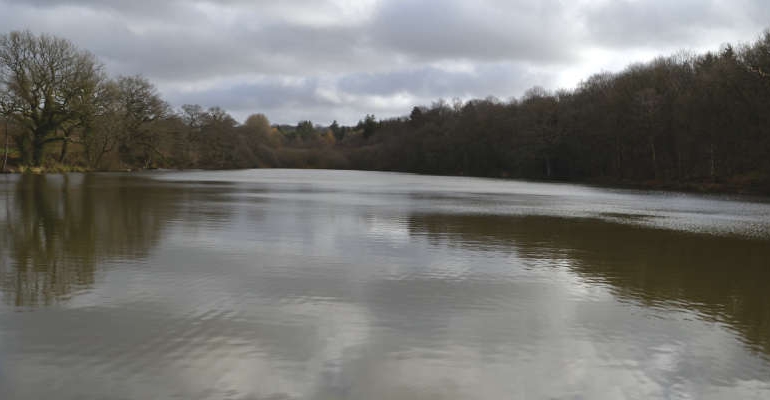
With the arrival of British Summer Time and longer hours of daylight we sent Robert Veitch to pastures new for a walk to remember, encapsulating the rolling landscape and living history surrounding the pretty village of Horsted Keynes
From the Chapel Lane car park stroll back towards the road, the green and crossroads, crossing over to the bollards and heading downhill beyond them towards the distant church. Continue along Church Lane, dipping downhill then up the other side.
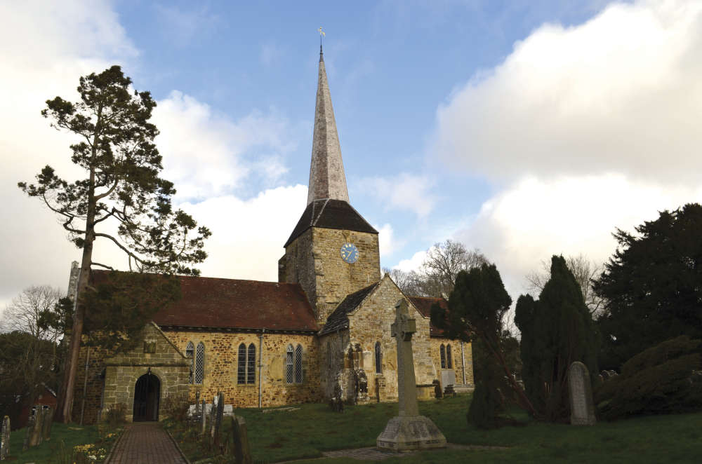
St. Giles Church is a worthy distraction for a few minutes. Potter around to the back of the graveyard and the final resting place of former Prime Minister Harold Macmillan can be found in the beech hedged family plot.
Back on the road, continue north past the school to the metal 7-bar gate. The cinder track beyond the gate leads downhill through Church Wood and across the lake dam. Continue along the cinder track, passing another six lakes on the left. Only the occasional movements of sedentary anglers and the chattering of ducks punctuate these idyllic pools of solitude.
Just beyond the metal 7-bar gate bear left at the fork and uphill, turn 90° right, 90° left, and continue past the 16th century Broadhurst Manor that used to be the home of screenwriter Carla Lane (The Liver Birds, Butterflies, Solo, Bread) all the way to the junction with Broadhurst Manor Road.
Turn left and walk uphill to the junction with Chilling Street. Turn right and continue north for 200m to fingerposts on either side of the road, by the thatched roof. At 107m (352ft) it’s the highest point of the day.
Head left, through the metal gate, towards the steeple of All Saints Church in Highbrook across the valley, and wander downhill between the hedge and stock proof fence. Keep an eye on the sky for buzzards circling overheard. Continue all the way to the kissing gate at the entrance to Hang Wood.
Stroll downhill, through a plethora of roots to the narrow footbridge across the stream then up the other side and into the open space of the crop field. Hug the right side of the boundary, past two fingerposts, before turning right at the third.
Head downhill into the wonderful wooded glade of Long Plantation, tiptoeing through the wild garlic near the dam. Cross the dam and spillway with care, then through the gate and across the field towards the telegraph pole and picket gate beyond, which leads to Horsted Lane.
Turn left and along road for 50m before turning right by the fingerpost and following the path to the stile into the field. Keep left in the field, treating any livestock with respect, continuing to the next stile then to the track by the railway bridge.
Across the stile on the other side of the track keep to the right of the field for 250m before squeezing through the kissing gates on either side of the railway lines, which must be crossed with great care.
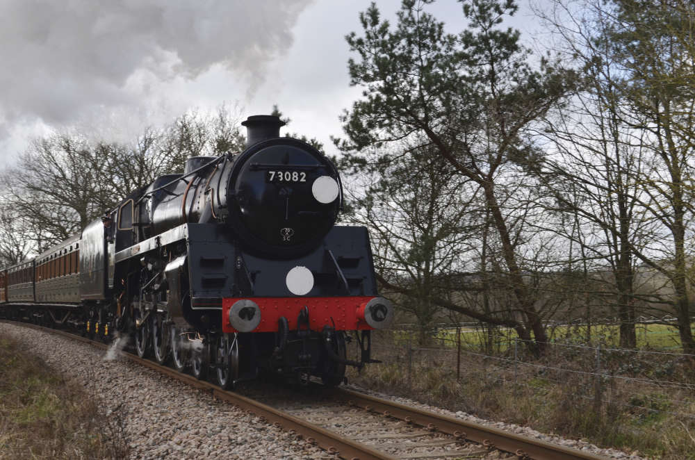
Turn left on the far side of the train tracks and follow the path to the metal gate. Then over the stile on the right and through the grids of juvenile trees, following the path as it double backs on itself, over the railway bridge and into the car park.
Follow the track for 150m before turning left towards the redundant kissing gate at the edge of Leamland Wood. Once past it, follow the path between the woods and the dilapidated fence, then post and rail fence to the junction with Cinder Hill.
Turn right and walk with care, along the road, past Station Approach to the fingerpost and chevron sign on the bend.
Turn right and follow the track through Little Oddynes Farm, past the metal 7-bar gate and stile, to the railway bridge. In the field beyond, follow the right hand side to the stile, but do not cross the stile.
Turn left and follow the field boundary for another 250m (past the redundant stile) crossing the stile by the fingerpost at the gap in the hedge. Turn left and follow the track over Cockhaise Brook to the junction with Keysford Lane, which at 40m (131ft) is the lowest point of the day.
Turn left, then after 75m, turn right into the woods and continue to the open field. Walk up the dividing line between pasture and crops to the chalk track then follow the chalk between the wire fences and gateposts, uphill to the drinking troughs. Turn left at the troughs, through the kissing gate then follow the periphery of the field to another kissing gate and then the junction with Treemans Road at the edge of the village.
Turn left and saunter along the tarmac for 300m to the junction with Lewes Road. Veer right into Lewes Road and follow the pavement, past the assorted character properties, which leads back to the green, the car park and the last of the spring daffodils.
There’s a pub or two beyond… now there’s an idea!
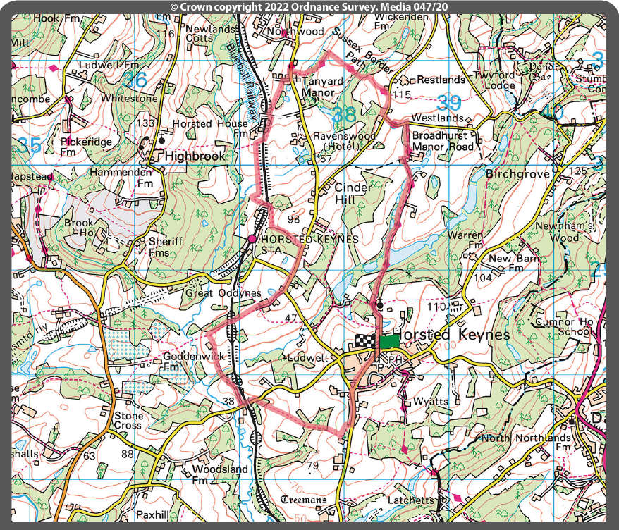
Distance: 6.75 miles
Walk Time: 2 1/2 – 2 3/4 hours
Stiles: 8
Kissing Gates: 6
Footwear: Appropriate footwear for April is recommended, as it may be muddy in places
Elevation Gain: 138m (452 feet)
Calorie Burn: Approximately 625kcal
Map: OS Explorer 135
Parking: Free parking in the public car park, off Chapel Lane
Robert has tested the route personally, making sure it is suitable for walking. However, even he cannot guarantee the effects of the weather, or roadworks, or any other factors outside of his control. If you would like to send your feedback about a local walk, please email editorial@sussexliving.com

 Playtime: Board Games
 If You Ask Me: The Pothole Gardener
 It's a Dog's Life: A Decade of Dog!
 December Book Reviews
 If You Ask Me: Flo’s Virtual Bookshop
 Kids Zone: Christmas Traditions
 Book Reviews: November Novels... and more!
 What to Watch in October 2024
 Kids Zone: Spooky Spider's Webs
 If You Ask Me: Humanity's Greatest Invention
 If You Ask Me: A Desert Island Drag
 Kids Zone: Mud Kitchens
 What to Watch in July 2024
 Kids Zone: Ice Block Treasure Hunt!
 What to Watch in June 2024
 A Gourmet Escape on the Eurostar: London to Amsterdam with Culinary Delights in Almere
 If You Ask Me: Train Announcements Have Gone Off the Rails
 If You Ask Me... Never Argue with an Idiot
 Kids Zone: Mosaic Art
 What to Watch in April 2024